 Tweet
Tweet

For better resolution: LINK
Something more about the map:
Title: Totius Gratiae Descriptio Dni Jacobi De Gastaldis Cosmographi Generoso Ac Magnifico
Map Maker: Giacomo Gastaldi
Place / Date: Venice / 1560
Coloring: Uncolored
Size: 26.5 x 19 inches
Description:
One of the earliest obtainable modern maps of greece, Macedonia, Montenegro, Albania, the western coast of Asia Minor, and northern Crete, from one of the most important map makers of the 16th Century.
A good example of Gastaldi' the first edition of Gastaldi' rare 2-sheet map of greece, for which Gastaldi was granted a privilegio on July 29, 1560, at the same time as he received papal priviledges for his maps of Italy and Lombardy and 2 of the 3 sheets in his map of Asia. The map of Greece was engraved by Fabio Licinio and included a separately printed index of place names, which would have been available either as a broadside or a pamphlet. While the title is simlar to Nikolaos Sophianos's Totius Graeciae Descriptio, first publshed in 1544 and would certainly have been known to Gastaldi, the map is a significant departure from Sophiano's presentation and is significantly revised in certain parts of the map.
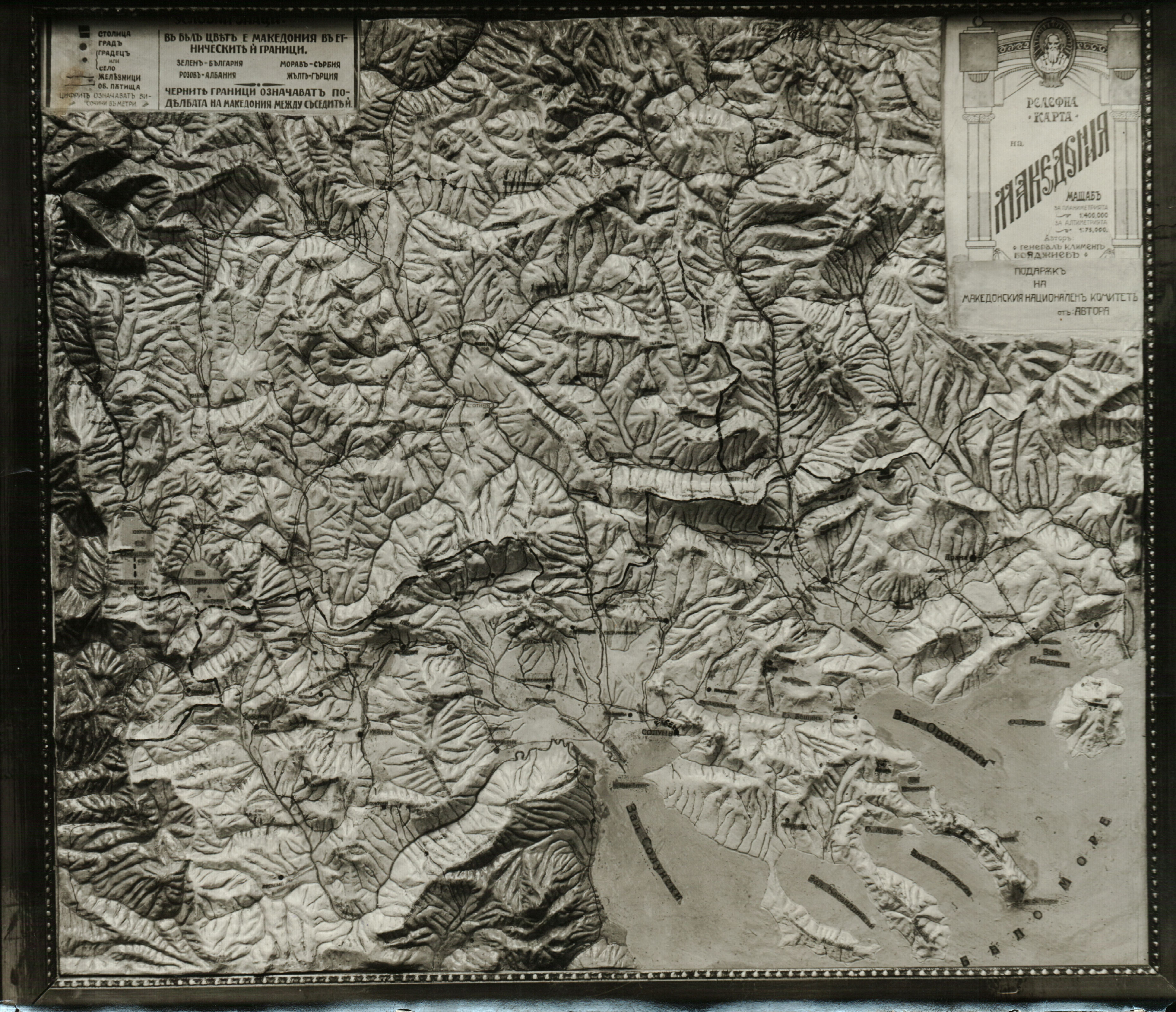
The map became the most important map of the region published in the 16th Century, and was later copied by other Lafreri School map makers including Bertelli and used by Ortelius as the source for his map. Among other things, the map provides one of the more realistic geographical maps of Macedonia, using for the first time many Macedonian place names, including the Vardar River, Skopje, Mt. Skopska Crna Gora, Tikvesh Valley, Demir Kapiya, Bitola, Kratovo, Struga, Ohrid and Ohrid Lake, Prespa and Prespa Lake, Prilep, Kostur, Lerin, Voden and Resen.
izvor: https://www.raremaps.com/gallery/arc.../Gastaldi.html


Comment